- Image
Also known as Butte, or Desert Station, it was named for the black basalt outcropping just to the north of the road and the monument. Sharp says it was also known as Rock House. Initially called Butte or Desert Station, the rock structure was constructed as part of trail improvements undertaken by the Overland Mail Company after acquiring the Express in July 1861.
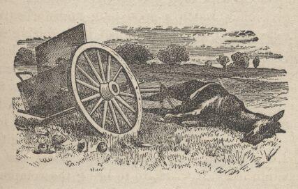
Little is known about Blackrock station, or its usage possibly due to it being a non-contract station. A structure of native black stone was apparently built here in 1861, while other structures in the area are suggested. Reconnaissance and infrared photographs have also failed to produce any evidence. Only a vandalized monument marks its general location.
Informants say the station site lies west and north of the volcanic outcrop known geographically as Blackrock. The old Lincoln Highway (1913-1927) first encountered and utilized the old Overland Route about ¼ mile east of the monument. This routing was used as an alternate to the main road during wet weather.
Fike and Headley list this station thirteen and three-fourths miles from Dugway. Several sources identify Black Rock or Blackrock as a station between Dugway and Fish Springs, although Fike and Headley add Butte and Desert Station as alternative names. The exact location of the station, originally known as Butte or Desert, remains unknown. The Overland Mail Company may have erected a stone structure near the Blackrock volcanic formation after July 1861, but its connection with the Pony Express is uncertain because it did not appear on the 1861 mail contract. A damaged monument marks the general area of the station site.
Note: Burton does not speak of a station in this area but he does describe the crossing from Dugway to Fish Springs.
Having reached the plain the road ran for eight miles over a broken surface, with severe pitch holes and wagon tracks which have lasted many a month; it then forked. The left, which is about six miles the longer of the two, must be taken after rains, and leads to the Devil's Hole, a curious formation in a bench under "High Mountain," about ninety miles from Camp Floyd, and south, with a little westing, of the Great Salt Lake. The Hole is described as shaped like the frustrum of an inverted cone, forty feet in diameter above, twelve to fifteen below. As regards the depth, four lariats, of forty feet each, and a line at the end, did not, it is said, reach the bottom. Captain Simpson describes the water as brackish. The drivers declare it to be half salt. The Devil's Hole is popularly supposed to be an air vent or shaft communicating with the waters of the Great Salt Lake, in their subterraneous journey to the sea (Pacific Ocean). An object cast into it, they say, is sucked down and disappears; hence if true, probably the theory.
We chose the shorter cut, and after eight miles rounded Mountain Point, the end of a dark brown butte falling into the plain. Opposite us and under the western hills, which were distant about two miles, lay the station, but we were compelled to double, for twelve miles, the intervening slough, which no horse can cross without being mired. The road hugged the foot of the hills at the edge of the saleratus basin, which looked like a furrowed field in which snow still lingers. In places warts of earth tufted with greasewood emerged from hard, flaky, curling silt cakes; in others, the salt frosted out of the damp black earth like the miniature sugar plums upon chocolate bonbons. We then fell into a saline, resembling freshly fallen snow. The whiteness changes to a slaty blue, like a frozen pond when the water still underlies it; and to make the delusion perfect, the black rutted path looked as if lately cut out after a snow storm. Weird forms appeared in the moonlight. A line of sand heaps became a row of railroad cars; a raised bench was mistaken for a paling; and the bushes were any thing between a cow and an Indian. This part of the road must be terrible in winter; even in the fine season men are often compelled to unpack half a dozen times.
After ascending some sand hills we halted for the party to form up in case of accident, and Mr Kennedy proceeded to inspect while we prepared for the worst part of the stage - the sloughs. These are three in number, one of twenty and the two others of 100 yards in length. The tule, the bayonet grass, and the tall rushes enable animals to pass safely over the deep slushy mud, but when the vegetation is well trodden down, horses are in danger of being permanently mired. The principal inconvenience to man is the infectious odor of the foul swamps. Our cattle were mad with thirst; however, they crossed the three sloughs successfully, although some had nearly made Dixie's Land in the second.
(The City of the Saints, pp458-9)