- Image
Simpson’s Springs/Egan’s Springs/Lost Springs Station (N40 02 22.0 W112 47 15.3)
The station now located on BLM land, bears the name of explorer Captain J. H. Simpson who stopped here in 1858 while searching for the overland mail route between Salt Lake City and California. It was one of the most dependable watering points in this desert region. Captain Simpson first named the spring “Pleasant Spring” because of the good water. He later renamed the spring “Simpson Springs” because of the spring’s significance as the “last stop for water” for travelers heading west. The water at became a necessity for the Pony Express from 1860-1861 and for the Overland Stage from 1861 to 1869. Even before the days of the Pony Express, freighting companies used the springs as a watering stop. George Chorpenning established a mail station at this site in 1858. At the turn of the century, the spring was still being used by freighters hauling supplies from mining towns around Gold Hill to western Utah. It is still a key watering location for livestock.
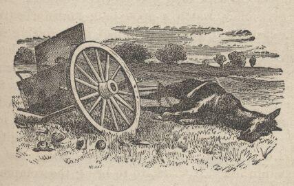
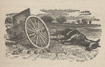
A number of structures have been built and destroyed in the vicinity of Simpson Springs over the years. It is not known for sure which served as a station for both the mail route and the Pony Express. There is a monument and restored structure (reconstructed in 1974 by the FFA) located on a building site which dates to the period (1860) and closely resembles the original. The site, nature and use of the old buildings were determined by archaeological investigation. It also has an information kiosk and ruins of Alvin Anderson’s cabin. Nearby is a camp ground and the site of a Civilian Conservation Corp camp from the 1930′s.
The first east-bound Pony Express courier halted here about 5 p.m. April 7, 1860 and westbound about 2 a.m. April 10, 1860. The last riders passed October 1861. The coming of the Overland Telegraph made it inadvisable to continue this station.
The 1861 mail contract listed Simpson's Springs as a route site, which other sources also identify as Pleasant Springs, Egan's Springs, and Lost Springs. Fike and Headley place this station eight miles west of Government Creek. George Chorpenning found the site promising in 1851, with a good source of water, and stone structures were erected soon thereafter. These structures probably housed Pony Express and stage operations, after Russell, Majors, and Waddell and the Central Overland California & Pike's Peak Express Company assumed the Chorpenning contract in May 1860. George Dewees managed the station. The station received its name from J. H. Simpson, a Camp Floyd topographical engineer who in 1859 laid out an acceptable route from Salt Lake City to Carson Valley.
Activities at Simspon's Springs declined after the Pony Express and stage eras until the 1890s, when miners and other travelers began stopping at the site on their way to and from the Gold Mill area.
Passing out of Skull Valley, we crossed the cahues and pitch holes of a broad bench which rose above the edge of the desert, and after seventeen miles beyond the Pass reached the station which Mormons call Egan's Springs, anti-Mormons Simpson's Springs, and Gentiles Lost Springs.
Standing upon the edge of the bench, I could see the Tophet in prospect for us till Carson Valley; a road narrowing in perspective to a point, spanned its grisly length, awfully long, and the next mail station had shrunk to a little black knob. All was desert: the bottom could no longer be called basin or valley: it was a thin fine silt, thirsty dust in the dry season, and putty like mud in the spring and autumnal rains. The hair of this unlovely skin was sage and greasewood: it was warted with sand heaps; in places mottled with bald and horrid patches of salt soil, while in others minute crystals of salt, glistening like diamond dust in the sunlight, covered tracts of moist and oozy mud. Before us, but a little to the right or north, and nearly due west of Camp Floyd, rose Granite Mountain, a rough and jagged spine or hog's back, inhabited only by wolves and antelopes, hares and squirrels, grasshoppers, and occasionally an Indian family. Small sweet springs are found near its northern and southern points. The tradition of the country declares it to be rich in gold, which, however, no one dares to dig. Our road is about to round the southern extremity, wheeling successively S and SE, then W and NW, then SW and SE, and SW and NW - in fact, round three quarters of the compass; and for three mortal days we shall sight its ugly frowning form. A direct passage leads between it and the corresponding point of the southern hill: we contemplate, through the gap, a blue ridge where lies Willow Spring Station, the destination of our party after to morrow; but the straight line which saves so much distance is closed by bogs for the greater part of the year, and the size of the wild sage would impede our wagon wheels.
The great desert of Utah Territory extends in length about 300 miles along the western side of the Great Salt Lake. Its breadth varies: a little farther south it can not be crossed; the water, even where not poisonous, being insufficient. The formation is of bottoms like that described above, bench lands, with the usual parallel and perfectly horizontal water lines, leaving regular steps, as the sea settled down, by the gradual upheaval of the land. They mark its former elevation upon the sides of the many detached ridges trending mostly N and S. Like the rim of the Basin, these hills are not a single continuous mountain range which might be flanked, but a series of disconnected protrusions above the general level of the land. A paying railway through this country is as likely as a profitable canal through the Isthmus of Suez: the obstacles must be struck at right angles, with such assistance as the rough kanyons and the ravines of various levels afford .
We are now in a country dangerous to stock. It is a kind of central point, where Pavant, Gosh Yuta (popularly called Gosh Ute) and Panak (Bannacks) meet. Watches, therefore, were told off for the night. Next morning, however, it was found that all had stood on guard with unloaded guns.