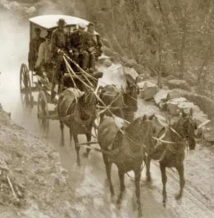
Known by a variety of names, including Bromley’s, Pulpit Rock, Hanging Rock, and Echo, it was Utah’s 4th contract station. The appearance of the station and its actual location have been the subject of much debate. Old photographs are available, but as David Jabusch notes, “Interpretation of these old photographs is more an art than the science one might suppose.” By the time of the Pony Express, a small village existed here, and it is difficult to determine which of the photographed structures might have served as the station. Modern developments including the building of the railroad, U.S. Highway 30, and later, the Interstate freeways have destroyed much of the original topography, including the Obelisks and Pulpit Rock, making futile any appeal to archaeology. James Bromley settled here in 1854. He was later hired by Russell, Majors, and Waddell as division superintendent for the section of the line between Pacific Springs and Salt Lake City, and his ranch at Weber became the Pony Express and Stage station.
Passing through in 1859, Greeley found “Two ‘groceries,’ a blacksmith’s shop, and a mail station” at the location. Burton also describes the location, saying, “…we debauched upon Weber River Station. It lies at the mouth of the ravine almost under the shadow of the lofty red bluffs, called ‘The Obelisks,’ and the green and sunny landscape contrasting with the sterile grandeur behind, is exceedingly pleasing…. The station was tolerably comfortable, and the welcome addition of potatoes and onions to our fare was not to be despised.”
About 2 miles west of Weber Station, the mail was transported across Forney’s Bridge on the Weber River. The bridge was constructed prior to June 1858. From this location, the Express riders traveled up Bachelors Canyon to the top of Dixie Hollow. When the crossing was unsafe or the canyons were snowed in, the rider could go on down the valley to the Brimville Emergency Station or Henneforville, now Henefer and around by Little East Canyon to Dixie Hollow. The pioneer immigrants came part way down Dixie Hollow, turned right, crossed the ridge, and then went south into East Canyon. By the time of the Express, the road was built all the way down the hollow to just south of where it opens into East Canyon. (Expedition Utah)
This site appears on the 1861 mail contract. James E. Bromley, division superintendent for stations between Pacific Springs, Wyoming, and Salt Lake City, managed the station operations at Weber Station. The stone station house and other structures there housed a general store, inn, saloon, blacksmith shop, jail, and later, a hotel at this site. In 1868, the Union Pacific Railroad bought the station and surrounding property to establish Echo City. The Settles mention Weber as a stone stage and Pony station, built in 1853, at the mouth of Echo Canyon. The station maintained a large supply of food for man and beast in the form of locally grown vegetables and wild hay. Apparently, the station house stood until 1931, when workers demolished it for safety reasons.
Several other sources identify Weber as a Pony Express station, but they do not agree on its location. Bishop and Henderson locate the site between Half Way and Wheaton Springs (exact location unknown). Bloss places Weber between Needles and Carson House (exact location unknown). Pierson identifies the station between Hanging Rock (exact location unknown) and Henefer (exact location unknown). Kate B. Carter, of the Daughters of Utah Pioneers, also mentions Weber Station at the mouth of Echo Canyon. Pierson identifies Hanging Rock as a station between Echo Canyon and Weber. However, Fike and Headley list Hanging Rock as another name for Weber Station. (NPS)
