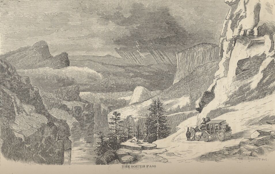
August 14, 1860, Richard Francis Burton passes through Fort Laramie; July 31, 1861, the Clemens brothers pass through Fort Laramie at night. Both parties travel over the Rocky Mountains, through South Pass and arrive in Salt Lake City
Burton's journey took considerably longer to complete the ride from Fort Laramie to Salt Lake City. According to his itinerary, he departed Fort Laramie August 14th and arrived in Salt Lake City August 28th. The Clemens brother's trip ran from August 1st to August 5th.
From Burton:
The mountain region westward of the sage and saleratus desert, extending between the 105th and 111th meridian (G) - a little more than 400 miles - will in time become sparsely peopled. Though in many parts arid and sterile, dreary and desolate, the long bunch grass (Festuca), the short curly buffalo grass (Siskria dactyloides), the mesquit grass (Stipa spata) and the Gramma, or rather as it should be called “Gamma” grass (Chondrosium faenum) which clothe the slopes west of Fort Laramie, will enable it to rear an abundance of stock. The fertile valleys, according to Lieutenant Warren, “furnish the means of raising sufficient quantities of grain and vegetables for the use of the inhabitants, and beautiful healthy and desirable locations for their homes. The remarkable freedom here from sickness is one of the attractive features of the region, and will in this respect go far to compensate the settler from the Mississippi Valley for his loss in the smaller amount of products that can be taken from the soil. The great want of suitable building material, which now so seriously retards the growth of the West will not be felt there.” The heights of the Rocky Mountains rise abruptly from 1,000 to 6,000 feet over the lowest known passes, computed by the Pacific Rail road surveyors to vary from 4,000 to 10,000 feet above sea level. The two chains forming the eastern and western rims of the Rocky Mountain basin, have the greatest elevation, walling in as it were the other sub ranges.
There is a popular idea that the western slope of the Rocky Mountains is smooth and regular; on the contrary, the land is rougher, and the ground is more complicated than on the eastern declivities. From the summit of the Wasach range to the eastern foot of the Sierra Nevada, the whole region with exceptions, is a howling wilderness, the sole or bed of an inland sweetwater sea, now shrunk into its remnants - the Great Salt and the Utah Lakes. Nothing can be more monotonous than its regular succession of high grisly hills, cut perpendicularly by rough and rocky ravines, and separating bare and barren plains. From the seaward base of the Sierra Nevada to the Pacific - California - the slope is easy, and the land is pleasant, fertile and populous. (p 7-8)