- Image
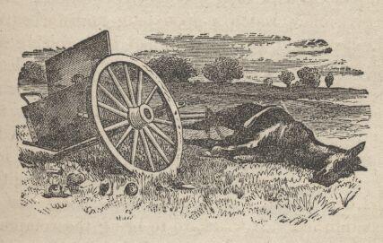
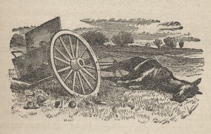
This station has had two names as there was two apparent attempts at a Pony Express station in Overland Canyon were destroyed by fire. The first was built in the mouth of Blood Canyon near available water, and seems to have been rather short-lived . The second Canyon Station was located just west of the monument (N40 04 37.0 W113 50 44.0) which is visible across a deep wash west of the road. The station is said to have consisted of a log house with adjoining stable, and a dugout where meals were cooked and served. 5 express employees and 2 soldiers were killed when Canyon Station was burnt in July of 1863. Looking to the west across Clifton Flat, you will see a 2-track which is probably the remnant of the old stagecoach and pony express road. Both are on BLM land and nothing remains.
Canyon Station was strategically built in 1863 high above the mouth of Overland Canyon to replace an earlier, indefensible station located up Overland Canyon about 2-3 miles. Indians had beseiged and burned the original Canyon Station earlier the same year.
The original Canyon Station, also known as Burn’t Station, had been built by Howard Egan as an Express Station and was first described in August of 1861. A marker built and placed by the Civilian Conservation Corp (C.C.C.) is apparently located improperly in Township 9 South, Range 18 West, Section 2 (SE1/4NW1/4). The station is believed to have been in the form of a dugout located at the mouth of Blood Canyon, so named because of the Indian attack in 1863. Other evidence indicates the site may be to the west on Clifton Flat. Descriptions vary on structural features. Apparently a dugout with stable or barn was built and possibly a log house.
Locally called Round Station (N40 02 40.5 W113 48 15.0), this recent connotation originates because prior to archaeological investigations in 1974, the only discernible feature was a round, relatively complete, fortified rock structure, which included gunports. This had been interpreted as the station house. Excavations revealed the actual station house foundation (as well as the corral area) to be east of the round fortification. The Gale Parker’s recall their grandfather having spoke of a roof being on the fortification.
Artifacts collected indicate no extensive use after 1870. The Bureau of Land Management has stabilized the fortification and the station foundation, and has provided an interpretive ramada and parking facilities
This stabilized fortification, was built in 1863 to serve the Overland Stage. It was probably the third incarnation of Canyon Station, the first 2 having been burned by Indians. The ruin is that of a structure probably used for defense, and the foundation of the station is visible to the south and east across the parking lot. The interpretation is the product of a cooperative agreement among the BLM, National Park Service, and the Utah Division of the National Pony Express Association.
The exact location of this station site remains unknown. Sources generally list the site as Canyon or Burnt Station. Howard Egan built the original Canyon Station for the Pony Express, possibly near Overland or Blood Canyon or on Clifton Flat. The site's structures possibly included a dugout, stable, and log house. Fike and Headley suggest that a Civilian Conservation Corps marker incorrectly identifies the station site location.
In 1863, two years after the Pony Express ended, Indians attacked Canyon Station, killing the residents, and burning the buildings. That same year, workers built a round, fortress-like structure above the mouth of Overland Canyon to replace the burned station. Local people distinguished between the two stations by referring to the burned station site as Burnt or Burnout, and the replacement as Round Station. Confusion occasionally arises from the reference to Canyon Station, but the second station, built after 1863, had nothing to do with the Pony Express.
At 6 AM the thermometer showed 45 F; we waited two hours, till the world had time to warm. After six miles we reached "Mountain Springs," a water sink below the bench land, tufted round with cotton wood, willow, rose, cane, and grass. On our right, or eastward, lay Granite Rock, which we had well nigh rounded, and through a gap we saw Lost Springs Station, distant apparently but a few hours' canter.
Between us, however, lay the horrible salt plain, - a continuation of the low lands bounding the western edge of the Great Salt Lake, - which the drainage of the hills over which we were traveling inundates till June.
After twelve miles over the bench we passed a dark rock, which protects a water called Reading's Springs, and we halted to form up at the mouth of Deep Creek Kanyon. This is a dangerous gorge, some nine miles long, formed by a water course which sheds into the valley of the Great Salt Lake. Here I rode forward with Jim, a young express rider from the last station, who volunteered much information upon the subject of Indians. He carried two Colt's revolvers, of the dragoon or largest size, considering all others too small. I asked him what he would do if a Gosh Yuta appeared. He replied, that if the fellow were civil he might shake hands with him, if surly he would shoot him; and at all events, when riding away, that he would keep a "stirrup eye" upon him; that he was in the habit of looking round corners to see if any one was taking aim, in which case he would throw himself from the saddle, or rush on, so as to spoil the shooting - the Indians, when charged, becoming excited, fire without effect. He mentioned four Red Men who could "draw a bead" against any white, usually, however, they take a minute to load, they require a long aim, and they stint their powder. He pointed out a place where Miller, one of the express riders, had lately been badly wounded, and lost his horse. Nothing, certainly, could be better fitted for an ambuscade than this gorge, with its caves and holes in snow cuts, earth drops, and lines of strata, like walls of rudely piled stone; in one place we saw the ashes of an Indian encampment; in another a whirlwind, curling, as smoke would rise, from behind a projecting spur, made us advance with the greatest caution.
(The City of the Saints, p 462-3)