- Image
Note: Point plotted is the location of the old bridge 42.836667, -106.371111
Located 15 miles from Bridger Station and 10 miles from Red Butte Station in the present Fort Caspar area just west of the south end of the marker for Old Platte Bridge. The Station Tender was Louis Guenot.
Casper – From Independence Rock the Pony Express Trail parts proximity with paved highway and heads across country to Casper which began as a ferry site on the Oregon Trail in 1847, when a group of Mormon emigrants, who were camping here, realized that there was money to be made by boating travellers across the North Platte River.
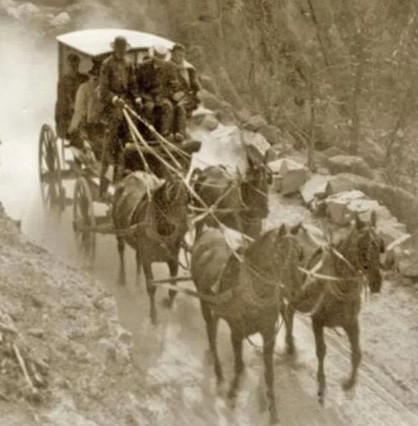
The center piece of the Platte Bridge Station and Fort Caspar was the bridge built here by Louis Guinard in 1859-1860. The bridge superstructure stood on 28 wooded cribbens filled with rock and gravel. Not counting the approaches, the bridge was 810′ long and 17′ wide. The total cost of construction was estimated at $40,000. The toll for wagons to cross was $1 – $6 determined by the height of the river. An additional toll was charged for animals and people. A military post (later named Fort Caspar) was established to protect the span and its traffic. The bridge was used until Fort Caspar was abandoned in 1867. (Expedition Utah)
According to Raymond and Mary Settle, in 1859, Louis Guenot built Platte Bridge Station at a cost of $40,000 and then served as its manager. Several additional sources name North Platte or (Fort) Casper as a station, largely because this name appears on the 1861 Overland Mail Company contract. Other sources mention Platte Bridge Station, on the North Platte River, as the site of this station. Franzwa locates Platte Bridge near Fort Caspar on his maps, but he does not identify either site specifically as a Pony Express station. (NPS)