- Image

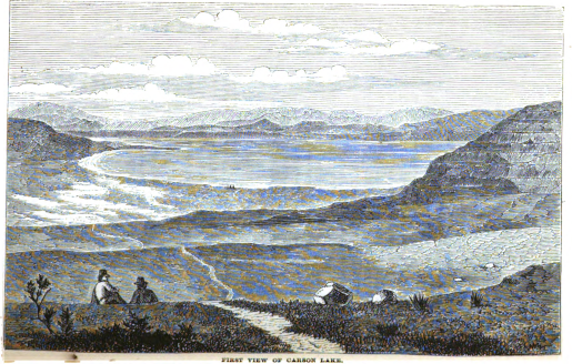
About 11 A.M. we set off to cross the ten miles of valley that stretched between us and the summit of the western divide still separating us from Carson Lake. The land was a smooth saleratus plain, with curious masses of porous red and black basalt protruding from a ghastly white. The water-shed was apparently to the north, the benches were distinctly marked, and the bottom looked as if it were inundated every year. It was smooth except where broken up by tracks, but all off the road was dangerous ground: in one place the horses sank to their hocks, and were not extricated without difficulty. After a hot drive-the glass at 9 A.M. showed 74° F.—we began to toil up the divide, a sand formation mixed with bits of granite, red seeds, and dwarf shells, whose lips were for the most part broken off. Over the fine loose surface was a floating haze of the smaller particles, like the film that veils the Arabian desert. Arrived at the summit, we sighted for the first time Carson Lake, or rather the sink of the Carson River.
NPS reference 148. SAND HILL STATION, Bishop and Henderson, as well as the government mail contract of 1861, identify Sand Hill as a station between Sand Spring and Carson Sink. Little else is known about this isolated station.