- Image
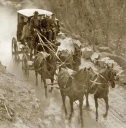
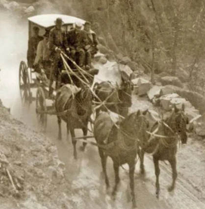
Pacific Springs is identified as a station in several sources. Located approximately two miles west of the Continental Divide, Pacific Springs served as a relay station for both stage lines and the Pony Express. Franzwa lists Pacific Springs in his Oregon Trail maps, but he does not identify it as any type of station. The British traveler, Richard Burton, in his narrative mentioned that the stage road crossed Pacific Creek two miles below Pacific Springs, and no doubt Pony Express riders followed the same path. (NPS)
Located 12 miles from the Upper Sweetwater Station and 12 miles from Dry Sandy Station. Station Tender was Botswain. A favorite camp site for emigrants ‘just over the hump.’ The water of the spring originates less than 4 miles from the Continental Divide and eventually reaches the Pacific Ocean. Here is the site of a stage and pony express station of the early 1860′s.
(Expedition Utah)
"We bowled along cheerily, and presently, at the very summit (though it had been all summit to us, and all equally level, for half an hour or more), we came to a spring which spent its water through two outlets and sent it in opposite directions. The conductor said that one of those streams which we were looking at, was just starting on a journey westward to the Gulf of California and the Pacific Ocean, through hundreds and even thousands of miles of desert solitudes. He said that the other was just leaving its home among the snow-peaks on a similar journey eastward—and we knew that long after we should have forgotten the simple rivulet it would still be plodding its patient way down the mountain sides, and canyon-beds, and between the banks of the Yellowstone; and by and by would join the broad Missouri and flow through unknown plains and deserts and unvisited wildernesses; and add a long and troubled pilgrimage among snags and wrecks and sandbars; and enter the Mississippi, touch the wharves of St. Louis and still drift on, traversing shoals and rocky channels, then endless chains of bottomless and ample bends, walled with unbroken forests, then mysterious byways and secret passages among woody islands, then the chained bends again, bordered with wide levels of shining sugar-cane in place of the sombre forests; then by New Orleans and still other chains of bends—and finally, after two long months of daily and nightly harassment, excitement, enjoyment, adventure, and awful peril of parched throats, pumps and evaporation, pass the Gulf and enter into its rest upon the bosom of the tropic sea, never to look upon its snow-peaks again or regret them.
I freighted a leaf with a mental message for the friends at home, and dropped it in the stream. But I put no stamp on it and it was held for postage somewhere."
Horace Greeley:
Passing the Twin Buttes—the distance between the mountains on the north and the hills on the south being not less than thirty miles, and thenceforth westward rapidly widening—we ran down the side of a dry, shallow water-course some five miles, to a wet, springy marsh or morass of fifteen or twenty acres, covered with poor, coarse grass, in which are found the so-called “Pacific Springs.” The water is clear and cold, but bad. Perhaps the number of dead cattle of which the skeletons dot the marsh, made it so distasteful to me. At all events, I could not drink it. This bog is long and narrow; and from its western end issues a petty brook, which takes its way south-westwardly to the Sandy, Green River, the Colorado and the Gulf of California. Hence, toward the south and west, no hills are visible—nothing but a sandy, barren plain, mainly covered with the miserable sage-bush.