In due course of time our journey came to an end at Kawaehae (usually pronounced To-a-hi—and before we find fault with this elaborate orthographical method of arriving at such an unostentatious result, let us lop off the ugh from our word “though”). I made this horseback trip on a mule. I paid ten dollars for him at Kau (Kah-oo), added four to get him shod, rode him two hundred miles, and then sold him for fifteen dollars.
Chapter 74 of Roughing It:
On the other side of the temple is a monstrous seven-ton rock, eleven feet long, seven feet wide and three feet thick. It is raised a foot or a foot and a half above the ground, and rests upon half a dozen little stony pedestals. The same old fourteen-footer brought it down from the mountain, merely for fun (he had his own notions about fun), and propped it up as we find it now and as others may find it a century hence, for it would take a score of horses to budge it from its position.
At noon, we hired a Kanaka to take us down to the ancient ruins at Honaunan in his canoe—price two dollars—reasonable enough, for a sea voyage of eight miles, counting both ways.
At four o’clock in the afternoon we were winding down a mountain of dreary and desolate lava to the sea, and closing our pleasant land journey. This lava is the accumulation of ages; one torrent of fire after another has rolled down here in old times, and built up the island structure higher and higher. Underneath, it is honey-combed with caves; it would be of no use to dig wells in such a place; they would not hold water—you would not find any for them to hold, for that matter. Consequently, the planters depend upon cisterns.
By and by we took boat and went ashore at Kailua, designing to ride horseback through the pleasant orange and coffee region of Kona, and rejoin the vessel at a point some leagues distant. This journey is well worth taking.
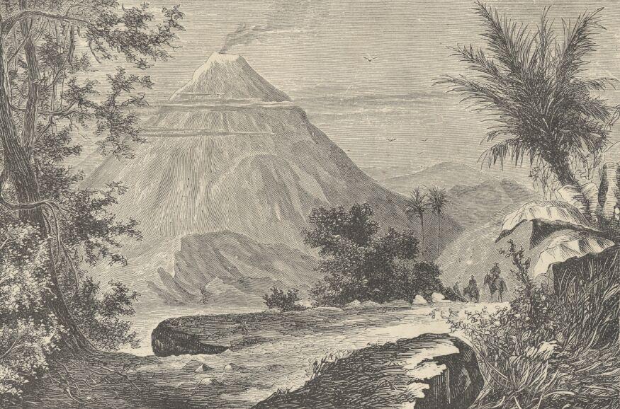
Monday morning we were close to the island of Hawaii. Two of its high mountains were in view—Mauna Loa and Hualaiai. The latter is an imposing peak, but being only ten thousand feet high is seldom mentioned or heard of. Mauna Loa is said to be sixteen thousand feet high.
Bound for Hawaii (a hundred and fifty miles distant,) to visit the great volcano and behold the other notable things which distinguish that island above the remainder of the group, we sailed from Honolulu on a certain Saturday afternoon, in the good schooner Boomerang.
Subscribe to
© 2026 Twain's Geography, All rights reserved.