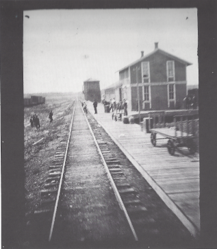
Following the Civil War, hostilities continued with the Sioux until the 1868 Treaty of Fort Laramie. By 1868, creation of new territories reduced Dakota Territory to the present boundaries of the Dakotas. Territorial counties were defined in 1872, including Bottineau County, Cass County and others. During the existence of the organized territory, the population first increased very slowly and then very rapidly with the "Dakota Boom" from 1870 to 1880. Because the Sioux were considered very hostile and a threat to early settlers, the white population grew slowly. Gradually, the settlers' population grew and the Sioux were not considered as severe a threat. The population increase can largely be attributed to the growth of the Northern Pacific Railroad. Settlers who came to the Dakota Territory were from other western territories as well as many from northern and western Europe. These included large numbers of Norwegians, Germans, Swedes, and Canadians. Commerce was originally organized around the fur trade. Furs were carried by steamboat along the rivers to the settlements. Gold was discovered in the Black Hills in 1874 and attracted more settlers, setting off the last Sioux War. The population surge increased the demand for meat spurring expanded cattle ranching on the territory's vast open ranges. With the advent of the railroad agriculture intensified: wheat became the territory's main cash crop. Economic hardship hit the territory in the 1880s due to lower wheat prices and a drought. The territorial capital was Yankton from 1861 until 1883, when it was moved to Bismarck. The Dakota Territory was divided into the states of North Dakota and South Dakota on November 2, 1889. The admission of two states, as opposed to one, was done for a number of reasons. The two population centers in the territory were in the northeast and southeast corners of the territory, several hundred miles away from each other. On a national level, there was pressure from the Republican Party to admit two states to add to their political power in the Senate.
https://en.wikipedia.org/wiki/Dakota_Territory
Clemens, Mrs. Pond, Olivia and Clara. Grand Fork, North Dakota/ July 30.
Mark Twain Archive, Elmira College courtesy of Kevin Mac Donnell, Austin, Texas.
July 30. In northern Dakota; no more wheat; but grass and billowy, rolling, just the Great Plains. Struck the Missouri at Williston D & followed it several hours to Fort Buford, a large post -- 7 p.m. on the border of Montana [NB 35 TS 19].
Grand Forks:
Grand Forks, at the fork of the Red River and the Red Lake River. This was an important trading point for the French and Indian trappers.
Larimore, a railroad town built in 1881 and named for a local farmer.
Mapes, at one time a thriving little town with a school, creamery, cheese manufacturing, hotels, dry goods store, elevator, bar, town hall, livery, garage and repair shop, restaurant, and churches.
Devils Lake, originally Sioux territory, or Lakota is you wish. They were all relocated to the Spirit Lake Reservation. The Sioux called the lake mni wak'an chante. The Whites thought this meant Bad Spirit Lake or Devils Lake. Actually, the water was undrinkable because of salinity. There is no devil in Sioux religion.
Rugby Junction, promoted as the geographic center of North America.
Minot was created when the Great Northern Railway ceased construction for the winter of 1886. When trains arrived, the conductor would announce "Minot, this is Minot North Dakota, prepare to meet your doom."
The Minneapolis, St Paul and Sault Ste Marie, or Soo Line, reach Minot in 1893.
The town is named after Henry D. Minot, a railroad investor and ornithologist.